Share
Since its launch in early 2017, the HDX Dakar Lab has been focused on increasing data access across West Africa. From our base in the OCHA Regional Office, we have built trusted relationships with volunteer communities, local NGOs, international organizations, and Government ministries. Below are a few highlights of our work which I hope will inspire new data collaborations in the years ahead.
Data sharing
Fourteen organizations from the region have registered on HDX over the past year. This includes ACF West Africa, Burkina Open Data Initiative, OCHA Cameroon, Terre des Hommes, the Senegal National Statistical Office, and ECOWAS Centre for Renewable Energy and Energy Efficiency, among others. Users based in countries throughout West Africa downloaded nearly 9,100 datasets in 2017 and Senegal is consistently among the top five locations for use of HDX.
The Lab also supported user research undertaken in Dakar and Guinea that led to HDX Connect, a feature that allows organizations to add metadata and share the underlying data privately. HDX includes ten datasets that are available by request. We hope this will create transparency around the data that exists while also protecting sensitive data from exposure.
Geodata
One of our biggest achievements was establishing an automated integration with Humanitarian OpenStreetMap Team (HOT), making it easier for our community to find and use up-to-date, crowdsourced geodata. In collaboration with HOT, we developed a tool to pull OpenStreetMap (OSM) data automatically into HDX, segmented by country and converted to data formats familiar to humanitarians. The technical collaboration with the HOT team has proved valuable not only in West Africa, but in other regions. Following the recent hurricanes in the Caribbean, HOT shared high-value data, including individual building locations, with HDX faster than ever before.
In addition, we are working with the OCHA Regional Office to make sure that Common Operational Datasets from West and Central African countries are available on HDX. This work involves finding reliable sources of data from Government agencies and then cleaning and processing the data before making it available through the platform.
Health data
Accurate data on health-facility locations is essential when responding to crises, as we saw with the Ebola crisis in 2014-15. The Lab team worked to integrate and visualize data from the Global Healthsites Mapping Project. These datasets are among the most popular on HDX. We have received positive feedback on the usefulness of this data from humanitarian responders working on the Cholera response in the DRC.
“The data I got from HDX was very useful. It allowed me to quickly map Cholera cases. It was also helpful to get the localization of health sites so I could prepare my field data collection.”
-Franck Alé, Médecins Sans Frontières (MSF)
Data skills
We piloted a data literacy workshop in Dakar in July 2017 with more than 45 participants in collaboration with the International Federation of Red Cross and Red Crescent Societies (IFRC). Following its success, OCHA and IFRC repeated the workshop in Nairobi in March 2018. We are currently in the planning stages for a similar event in Guinea which will focus on health data and be held in collaboration with USAID and the Guinea Ministry of Health and Public Hygiene.
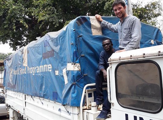
WFP support mission
In August 2017, WFP requested support to process data about the crisis in the Republic of Congo. Data had been collected on displacement in the Pool region and it needed to be cleaned and combined to create a common picture of the needs. An HDX Data Manager, normally based in Dakar, deployed for two weeks in September to work alongside local partners. The team created an interactive visualization to help the local Government and international organizations better understand displacement trends and humanitarian need.
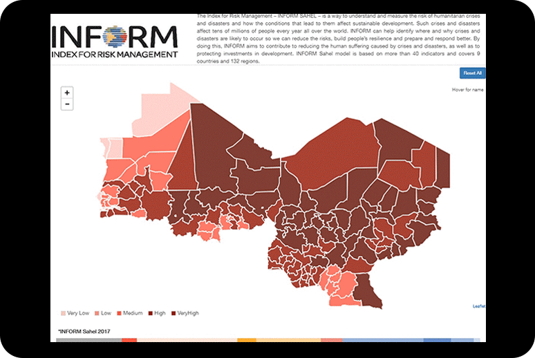
Data visuals
We have worked with partners to create a number of visuals to help understand data more easily. Here are a few examples:
- The Index for Risk Management, INFORM Sahel, measures the risk of humanitarian crises and disasters across nine countries in West Africa.
- The OCHA Somalia monitoring dashboard provides an overview by sector and by region of the number of people targeted and reached in the response.
- A visual from ACF shows the trends and anomalies of biomass, a measure of vegetation health, in the Sahel and can be used to monitor food insecurity in pastoralist community.
What’s Next
In late 2017, OCHA opened its Centre for Humanitarian Data in The Hague. The Centre manages HDX and our Lab. We are excited about the opportunities the new Centre brings to promote the value of data sharing globally but also here in West Africa.
We look forward to working with additional organizations such as Plan International, Save the Children, and MSF. We plan to work more with the Governments in Senegal and Guinea. If you are interested in collaborating with us, please be in touch! We are here to help.
Related blogs:
[…] HDX (PDF) Dakar Lab reports about last year’s successes. The open platform is responsible for the collection and […]