Share
The ongoing droughts in the African Sahel zone have triggered one of the longest-running crises faced by the international humanitarian community. Since the 1970s, the zone, which supports a largely agro-pastoralist population, has been in a near-continuous state of humanitarian crisis due to food insecurity caused by drought and desertification, and exacerbated (in some countries) by civil violence. The impact is uneven and shifting, so it’s critical to monitor trends like vegetation growth (including food for animals to graze on and crops that people grow) on a district-by-district basis.
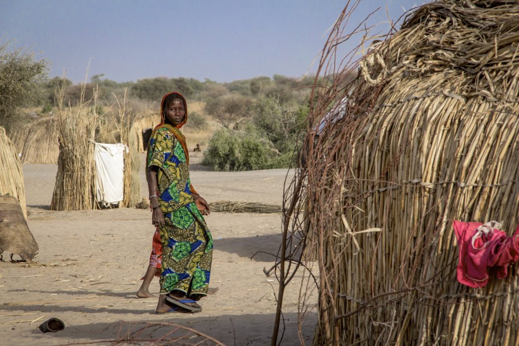
Mellia, Chad, 2 March 2016. On the IDP site in Mellia. The site was created spontaneously next to a small village of the same name, some 20 km from Bol, capital of Chad’s Lake region. Credit: OCHA/Ivo Brandau
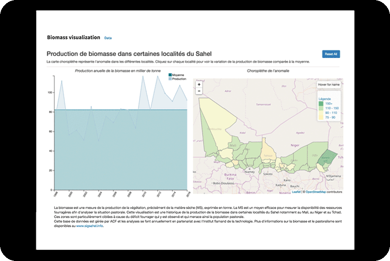
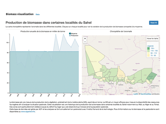
Tracking changes in biomass
Action Contre la Faim (ACF) maintains several datasets related to food security in the western part of the Sahel, including West Africa yearly biomass production, which is now available on the Humanitarian Data Exchange. This dataset shows the total estimated plant growth in metric tonnes for each year from 1998–2016 for Burkina Faso, Cameroon, Chad, Mali, Mauritania, Niger, Nigeria, and Senegal, disaggregated by level-two administrative subdivision (e.g. a Cercle in Mali, or a Département in Senegal). ACF assembles this data through close analysis of satellite imagery in a grid pattern, to detect the amount of vegetation present and track its changes from year to year (see visual below).
Why biomass matters in the Sahel
There are many ways that this data can help inform humanitarian planning and responses across different sectors and clusters. Here are some examples:
- Calculating the biomass per km² gives an indication of the district’s ability to support pastoralists and other agricultural industry at any specific time. It forms important baseline data for any multi-cluster needs analysis in the region.
- An abrupt decrease in a district’s biomass from year to year indicates a potential flashpoint for food insecurity in the near future, and possibly for crises in other sectors as well.
- An abrupt increase in a district’s biomass from year to year is an indirect indication of increased rainfall, and thus, heightened risk of mosquito-borne diseases such as malaria and dengue.
- Several consecutive years of poor production can indicate a decline in livestock health and an increased vulnerability of pastoralists to herd losses.
Using the data
Catherine Le Côme from SNV World explained how they use the biomass data as input to “Sustainable Technology Adaptation for Mali’s Pastoralists (STAMP),” a mobile information service that helps pastoralists make decisions about their seasonal migrations.
“The information service will give pastoralists more predictability and will contribute to reduce their exposure to risks,” said Le Côme. “It provides pastoralists with instant access to reliable information on biomass availability and quality, surface water availability, herd concentration and market prices for livestock and staple grains along the points of their different transhumance [seasonal migration] routes.”
Alexander Merkovic from ACF described the thinking behind the dataset’s creation. “Exploring historical data is important when making any kind of environmental analysis in the Sahel,” he said. “We wanted to show users what climate volatility looks like and how vulnerable certain areas might be one year to the next. This visualization really gives you an idea of how a zone can jump from lush to drought within a year and how difficult it can be for people to anticipate climate shocks.”
The data is also of interest to climate-change researchers analysing longer-term trends. It is available on HDX both as a shapefile, for use in GIS systems like QGIS or ArcGIS, and as a HXL-tagged spreadsheet. A better understanding of biomass and its change over time will help significantly with humanitarian planning in areas such as food security, livelihood protection, and disease risk assessment.
This collaboration with HDX is part of the ongoing services provided by the Dakar Data Lab. Since the beginning of the year, the HDX Dakar Data Lab has worked with many organizations throughout West Africa on data projects. The goal of the Lab is to increase access to data in support of humanitarian response efforts in the region. To find out more about the work of the Lab, email hdx@un.org or read our recent blog on activating data partnerships in West Africa.