Share
With millions of people fleeing hardship and violence in Syria as well as many other countries, the humanitarian community is facing significant challenges. Coordinating the response to such a massive, long-term humanitarian situation across the many national, international, and local response actors requires collaboration and partnership. It also requires interoperable data so that everyone has a common understanding of the crisis.
To address this, a group of UN and NGO organisations led by UNHCR, IOM, the Digital Humanitarian Network (DHN) and GISCorps are using OCHA’s Humanitarian Data Exchange (HDX) platform to share Common Operational Datasets (CODS) for the European Refugee and Migrant Response.
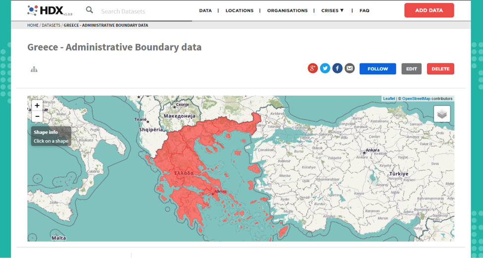
The administrative boundaries for some of the main affected countries in Europe (e.g. Greece & the former Yugoslav Republic of Macedonia) are now publicly available on HDX. This data enables responders to use the same standard names and identifiers when referencing affected areas and places. HDX provided a private workspace for exchanging earlier drafts of these datasets and data processing support to prepare the data.
We are looking for feedback on this data, including requests for other countries to be covered, the level of detail required, and other datasets that should be established to enable greater interoperability and facilitate response partnerships. Questions and comments can be directed to Javed Khan (khanjav@unhcr.org), Mohamed Rizki (mrizki@iom.int) and the DHN (datascramble@digitalhumanitarians.com).