Share
It has been seven weeks since Hurricane Matthew hit Haiti on 4 October 2016. HDX organizations shared 10 new datasets during the first week of the response. There were almost 25,000 pageviews of data on HDX during the first week of the hurricane, up from roughly 17,000 the week before. Users downloaded the Hurricane Matthew tagged datasets over 6,300 times from 1 October to 17 November.
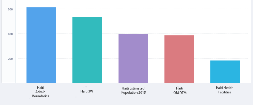
The top five downloaded datasets were:
1. Haiti Administrative Boundaries
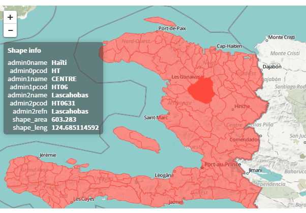
Haiti Administrative Boundary level 0 – 3. Source: Centre National de l’Information Géo-Spatiale (C.N.I.G.S) with pcodes created from government IDs. Spatial Data is from 2013.
3. OCHA Haiti Estimated Population, 2015
Below is a visual comparing the top five datasets, in terms of number of downloads from 1 October to 17 November.
Other popular datasets were: Road obstacles, UNOSAT population exposure, cholera cases by department and epidemiological week.
We would like to thank some of the most active data contributors during this period. This includes OCHA Haiti, International Organization for Migration, World Food Programme, Humanitarian OpenStreetMap Team, the Hurricane Matthew Coordinated Data Scramble, and the British Red Cross Maps Team.